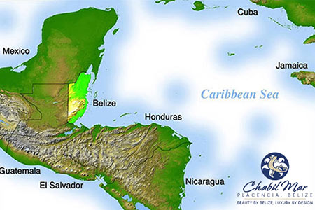
Belize is located in Central America between Mexico’s Yucatan Peninsula and Guatemala. Belize is the only English-speaking country in the region and has a long coastline on the Caribbean Sea.
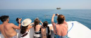
Although relatively small, Belize has an incredibly diverse landscape, including misty mountains, enormous waterfalls, pristine rivers, savannah, jungles teeming with wildlife, massive cave systems, and hundreds of offshore islands along the Belize Barrier Reef, the second-largest barrier reef in the world.
Misconceptions About Belize
Is Belize an island?
No. Belize is on the mainland of Central America, although it does have hundreds of offshore islands.
Is Belize located in the Caribbean?
Belize has a Caribbean culture as well as a lengthy coastline along the Caribbean, but Belize is not technically “in” the Caribbean as it is located on the mainland of Central America.
Is Belize located in South America?
No. Belize is in Central America. For purists that only consider South and North America to be true continents, Belize would be located in North America.
Is Belize in Honduras?
No. Belize was called British Honduras back during the colonial days, but it got this name because the southern part of the country opens onto the Bay of Honduras. Today, Belize and Honduras are two separate nations separated by a narrow band of land belonging to Guatemala. It takes about two hours with a boat to travel from Punta Gorda in the south of Belize to Puerto Cortez in Honduras.
What’s the Right Way to Spell Belize?
Over the centuries, Belize has been spelled lots of different ways, including Belieze, Belise, Balize, and Beleez. The official name of the country in English is Belize, which you better “Belize” matters to the people who live there!
Facts About Belize
- The official location of Belize is 17 degrees 15 minutes north and 88 degrees 45 west.
- Belize has approximately 360,000 people.
- English is the official language of Belize but other languages spoken in the country include Spanish, Mennonite German, Maya, and Garifuna.
- Belize is about two hours flying time from Miami or Dallas/Houston.
- Belize has 240 miles (386 km) of Caribbean coastline and hundreds of offshore islands.
- Belize has a landmass of around 8,860 square miles (22,960 square km), just a bit bigger than the state of Massachusetts.
- The highest point of land in Belize is Doyle’s Delight at 3,688 feet (1,124 meters).
- Islands in Belize are known as “cayes” (pronounced “keys”).
Belize Maps
Map of Placencia Belize
Map of Placencia and Chabil Mar
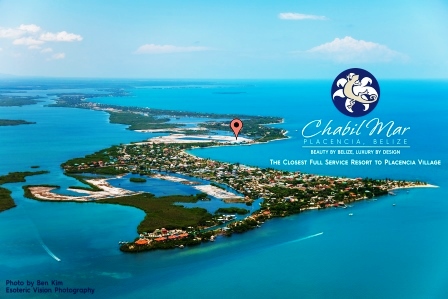
Only about 2,000 year-round residents live in the village located on the southern tip of the Placencia Peninsula. The village is a fifteen-minute stroll along the beach or 5-minutes by bike, kayak or paddle board from Chabil Mar. (Click on the Map for Larger Image and to Zoom)
Placencia Reef and Dive Locations Map
Many of the best diving spots along the reef are just minutes from Chabil Mar. This map shows these, including Laughing Bird Caye and Gladden Spit. (Click on the Map for Larger Image and to Zoom)
Belize Diving Map
Diving locations in and around the Belize Barrier Reef are numerous, and this map shows the best spots. (Click on the Map for Larger Image and to Zoom)
Belize Atolls Map
Often described as a “coral atoll”, an atoll is a ring of coral that has a lagoon in its center. The circumference of the atoll is dry land, and Belize has hundreds of these atolls in the Caribbean up and down the Belize Barrier Reef. (Click on the Map for Larger Image and to Zoom)
Belize Geography Map
Belize has a varied geography, with rolling hills and higher elevations in the southwest and west to lush agricultural flat lands in the north and southeast. Rainforest and jungle occupy much of Belize, and the country has a long coastline on the Caribbean with hundreds of offshore islands. (Click on the Map for Larger Image and to Zoom)
Map of Placencia, Belize
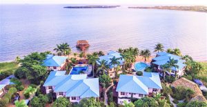
This 16-mile long finger of land is located on the coast of southeastern Belize in Stann Creek District. Chabil Mar is located just north of the village on the eastern side of the peninsula. (Click on the Map for Larger Image and to Zoom)
For more information about Belize, feel free to chat with our Concierge at: concierge@chabilmarvillas.com or contact our Reservations Manager at: reservations@chabilmarvillas.com. Or perhaps you would like to call toll free from the US or Canada: 1-866-417-2377.


