


Belize, a realm of tropical beauty nestled in the heart of Central America, has a plethora of hidden treasures waiting to be discovered. From ancient Maya cities to lush rainforests and stunning beaches, this country has something for every avid traveler. Among these attractions, there’s one gem that stands out, especially in the summer – the tranquil village of Placencia.
Placencia, a serene beachfront community located on the southern tip of the Placencia Peninsula, is your ticket to an idyllic summer getaway. Known for its 16-mile-long narrow sandy peninsula, crystal clear Caribbean waters, and a relaxed “barefoot perfect” vibe, Placencia is indeed the off-the-beaten-path destination you should explore this summer.
Why Placencia?

If you’re looking for a summer escape where you can truly unwind, soak up the sun, and embrace local culture, Placencia is the place to be. Unlike other popular tourist hotspots in Belize, Placencia offers a more relaxed, less crowded, and authentic experience of the Belizean lifestyle.
The Placencia Experience

Placencia is famous for its pristine sandy beaches, arguably the best in Belize. Imagine strolling along the coastline, feeling the warm sand beneath your toes, and occasionally dipping into the clear Caribbean waters to cool off. You’ll have the chance to enjoy this pleasure every day in Placencia.
But Placencia isn’t only about the beaches. The village offers a wide range of activities for adventure seekers. From snorkeling and diving in the world’s second-largest barrier reef to fishing, kayaking, and even exploring nearby jungle trails, there’s something for everyone.
Cultural enthusiasts will also find Placencia captivating. The village is home to vibrant local arts, crafts, and music scenes. Don’t miss the opportunity to explore the rustic charm of Placencia Village, where local artisans display their beautiful crafts.
Culinary Delights

One cannot talk about Placencia without mentioning its culinary delights. Belizean cuisine is a fusion of various cultures, and in Placencia, you can taste the best of it. From fresh seafood to local specialties like rice and beans, fry jacks, and the famous Belizean ceviche, your taste buds are in for a treat.
Where to Stay?

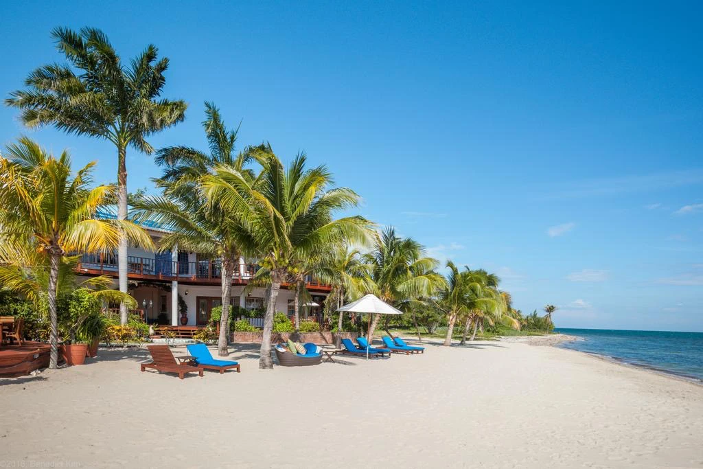
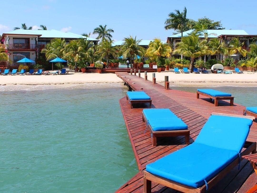
While exploring Placencia, it’s essential to find a comfortable and convenient place to stay, and there’s no better choice than Chabil Mar.
Chabil Mar, meaning “Beautiful Sea” in the local Mayan language, is a luxury resort located right on the beachfront. It combines the charm of Placencia’s natural beauty with world-class amenities, making it an ideal base for your summer adventures in Placencia.
With its beautifully designed villas, stunning infinity pools, a private beach, and top-notch dining options, Chabil Mar offers an unparalleled stay experience. What’s more, it’s strategically located close to Placencia Village, making it easy to explore local attractions.
Moreover, the resort’s staff are well known for their warm hospitality, always ready to assist and make your stay as comfortable and enjoyable as possible. Whether you’re looking for adventure activities, local tours, or dining recommendations, they’ve got you covered.
So this summer, take the road less traveled. Discover Placencia, immerse yourself in its tranquil beauty, savor its vibrant culture, and indulge in its delightful cuisine. And as you create unforgettable memories in this idyllic paradise, let Chabil Mar be your home away from home, enhancing your Belizean experience with its exceptional comfort and luxury.
Whether you’re a beach bum, an adrenaline junkie, a foodie, or a culture vulture, Placencia and Chabil Mar have something extraordinary to offer you. It’s time to write your own Belizean summer story, one that’s filled with adventure, relaxation, and the unforgettable charm of Placencia.
Take the plunge, venture off the beaten path, and you’ll find yourself not just in another tropical paradise, but in a different state of mind, where the pace is relaxed, the beaches are tranquil, and summer seems to last forever. In Placencia, Belize, you’ll find not just a vacation, but an experience that lingers in your heart, long after the summer sun has set.
So pack your bags, book your stay at Chabil Mar, and get ready for an extraordinary summer adventure in Placencia, Belize. You’re not just planning a vacation; you’re setting the stage for a journey of discovery, relaxation, and unforgettable memories. Let your summer story begin in Placencia, Belize.
Visit our website chabilmarvillas.com for more information on Belize, and don’t hesitate to send us an email, or call US/CAN Toll Free: 1-866-417-2377, Local: (011-501) 523-3606, if you have questions or need help in planning a Belize vacation.


Follow Us!